|
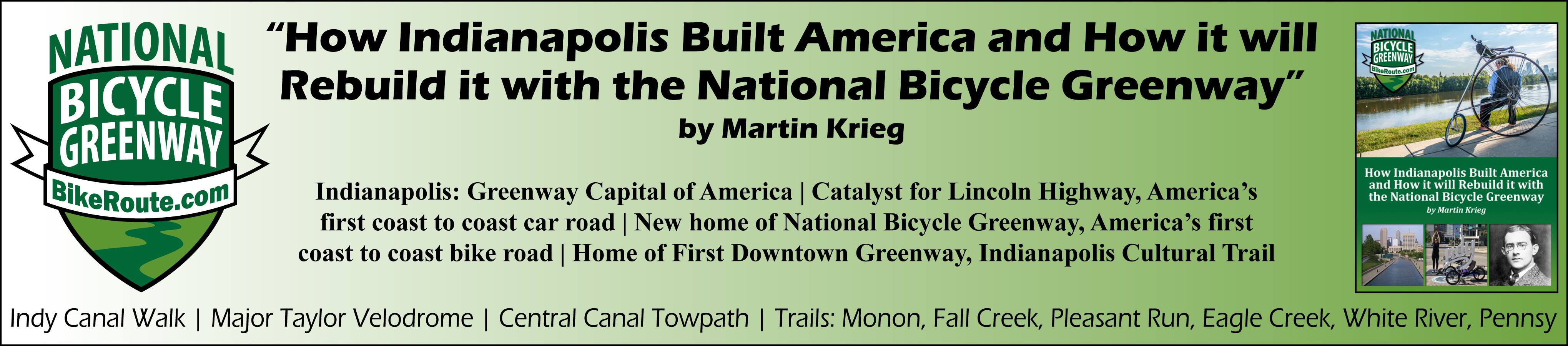
Mayors' Ride |
NBG Biking Cities |
Podcasts | Bicycles: Recumbents,
Busycle,
HiWheelers, Velomobiles Movements: Car Free,
Trailer,
|
|
Ray Irvin Interview
NBG: I’d like to know for our listenership how long you’ve been doing this with Indianapolis? Ray: I’ve been working on this since about 1986 so I’ve been working on this about 20 years now. NBG: Can you give us a feeling of the evolution of Indy Greenways? Ray: Well, I can give you some interest in it because back in the 80’s I moved into the inner city neighborhood of downtown Indianapolis and had bought an old building and started renovating it, and it becomes evident when you become involved in your community that there are so many things lacking. You see so many people out today willing to go down, invest their money, invest their time in trying to start rebuilding a city, but you need support from the inside and sometimes we don’t have the people in politics that have the vision of what could be. So I had run for the city council in ‘87 and won my council seat, won the race, and in 1988 I went on the city county council and right away started talking about some of the things that we need look at start considering in our communities. NBG: So you got on the council and what was the next evolution of that? There was something about a Greenway initiative. Ray: Well, if you’re gonna be successful at that you’ve gotta have somebody on the inside of the doors to kind of unlock the doors of the kingdom to get you in so you can at least be heard. And that’s a battle that we’re fighting constantly. You know, we’ve worked with the state legislature in the past, but it’s interesting every mayor in every city in this nation runs on a vision for their community. Mayor Hudnot (sp?) who had been the mayor of Indianapolis for quite a few years, had really latched onto a vision the last couple years he was in office, of creating the amateur sports capital of America here in Indianapolis and part of that vision was to start bringing amateur sports to Indianapolis making kind of a hub for that and it was a grand vision. Well one of the first things we did was to hire the Chamber of Commerce in 1988 to do what was called the GIFT report which was Getting Indianapolis Fit for Tomorrow. And in that report one of the first things they outlined was, they looked at quality of life and what did our parks and open space look like for the county based on our population. Well, based on that study, they came up rather quickly with the concept that we had a 20% parks land deficit in our county compared with what we should be with most cities around the country. That quality of life and deficit issue gets to be rather important when you’re trying to bring new businesses to your community and I don’t think there’s a community in America today that isn’t looking at how do they bring more business, how do they hang onto the business they have and how do they improve the quality of life to the point that people really want to live in these places. So this GIFT report was important because with this 20% parks land deficit, like most cities in America, Indianapolis is in some kind of a budget pinch. You know, gee, we can’t maintain what we have, how are we gonna create this 20% more parks land that we need. I’m somewhat of a student of history, and part of all histories in American cities is unique. In this particular city, along with lots of others, there was a gentleman at the turn of the last century, a gentleman named George Kessler, that had worked in our cities and had set aside what is known as parkway system. A parkway system at the time was green spaces along our rivers and streams and some very nice corridors, and that property was all set aside, but through a series of events over almost 80 years of history at that time, those areas had become known as floodways or flood plains, kind of negative context, they had become overgrown. Yeah there was a little grass along there in some places, but it was kind of a pain to keep it mowed and it was land that was just along our roads and they allowed it to kind of grow up and it didn’t mean much. We started talking about, maybe...I started talking about in particular, but I had some other people on the council, Dr. Cervas(sp?) and Beulah Coldenhour (sp?), one of our councilors, we started talking about how do we start connecting our community together. Maybe we don’t need more parks, maybe what we need is how do we connect our neighborhoods back to our parks, because with the growth of automobiles, thoroughfares, and all the other things, interstates, highways and state roads, we had kind of divided up our neighborhoods from a lot of the green space and yet, you look at this parkway system and it was a few hundred feet wide. There was a stream through it, there was trash in a lot of it, there was garbage in a lot of it, but you know, that could be cleaned up. And we could maybe take that land and use it as a ribbon running through our communities and start looking at connecting our neighborhoods back to our parks. And if you studied the land use plan and in particular our comprehensive land use plan, which this community has and a lot of cities around the country have, we had given these green strips this negative connotation of, well, that’s a flood plain because it floods a couple of times a year or it’s a floodway. Every time we have a storm event, you know the water comes over the banks a little bit. That kind of led to a negative in these areas and what we were saying is but wait a minute. There’s strips of land here and if we look at those lands differently and my proposal was that we create what I call today “linear parks”. These are narrow strips of land that are green space, reclaim that land for recreational use, start cleaning it up and let’s build trails on it so these kids who live in these neighborhoods, you know, a half a mile away from a park, can’t get there because there’s an interstate that prevents them from getting there safely, we would connect these areas back together. Well, by studying just that narrow piece of land along 14 greenway corridors at the time, we were able to add 5,000 acres of new land to our parks and greenway system by literally the stroke of a pen and we made up that deficit instantly. So we looked at the linear park as connecting over 52 parks in our community that laid along these rivers and streams. We then had a couple of old rail corridors that we started to look at and we can add even more neighborhoods to this grid of green spaces and we literally started building trails, By 1991 we had our first trail on the ground along Fall Creek and it was just kind of a demonstration project but it’s still there today. It was our first greenway, and from there we actually started building the greenways master plan and by 1994 we had a complete master plan changing the use of all of this floodway and flood plain space into either LP (Linear Park) or UC (Urban Conservation). I’ve written a paper on this, in fact, I’ll get it online with you if anybody ever wants to look at it. But we were able to make up that parks land deficit literally with the stroke of a pen and start on a new vision for our city. And in the course of doing it, literally met the issues that this GIFT report had laid out about quality of life and the need for parks land and basically with the stroke of a pen were able to check those issues off of that list of things that we needed to do to work toward this amateur sports capital vision the mayor had. NBG: That’s awesome. Going back to George Kessler, did he do work in New York City? Ray: He worked all over the country. George Kessler worked in cities from St. Louis, to I mean the list of cities he worked in around the country, yes he was in New York. He had also completed some of the work that Olmstead had started earlier in the late 1800’s and Kessler was a great advocate of these green spaces and there is a lot of that around today. If you live in a city where you don’t necessarily have a Kessler plan, I bet you anything that your department of public works in a lot of cases has set aside strips of land along rivers and streams that they see as flood ways or flood plains, and if that’s the case, then a lot of these cities have these linear green spaces. And Fall Creek does flood. We probably have the Fall Creek trail, portions of the Fall Creek Trail I should say, underwater probably 5 or 6 days a year at best. But that still gives you 360 days that you can be out there and use that land safely and it works. And it works everywhere I’ve seen it around the country and I think it’s a great piece of engineering that has been overlooked as far as it relates to the quality of life in our communities. NBG: Ray, the last time we talked you talked about you had 120 destinations that you access from these greenways, existing parkland being some of that stock. What kinds of places do these trails get to? Do they get to restaurants, dry cleaning...? Ray: Not exactly. Those are things that come along later, but when we first started looking at original destinations, some of the things we looked at was, we had 52 parks along our trails, actually I think it was 56 parks, and that was along the original 14 corridor greenways. We now have 20 corridors in our county and are looking at a couple more. We had over 25 schools along there. We had special interest places like the veteran’s hospital or the old Busch Stadium, or Central Hospital or the Idle (sp?) George Museum or the Indiana School for the Blind or any number of interesting destinations, the Indy Zoo. There’s all these wonderful places that we had. There’s also these certain areas that we had, the Massachusetts Avenue which is an arts and cultural district or Broad Ripple which is an arts and cultural district, or Fountain Square that’s an arts and cultural district. All of these areas that were also of interest, and also, in addition to that, we had what we called open space places which, we have one cemetery here, Crown Hill Cemetary, it is a huge cemetery, thousands of acres, some of the most famous people from the midwest are buried there, but the monuments and the landscaping and the trees and everything are beautiful. We had art museums, so when we talk about these 120 destinations, those were areas that when we started charting out these 14 original corridors, we could say that these were things that people would want to ride their bikes to see. And, you know, you throw the cemetery in and you go, gosh, there’s a tremendous amount of history there and it is a very beautiful space, so it’s a place you can now access by bicycle and ride through and just enjoy the history that just abounds in these areas. |
||
|
|
Copyright 2021 National Bicycle Greenway - We value your privacy. Please check our privacy
policy.
National Bicycle Greenway, Indianapolis & San Francisco 415-900-6861 NBG@BikeRoute.com
|